Your snow removal routes, planned, tracked and documented.
Snowbec plans your crews’ routes the night before, guides each driver on a tablet or a phone during the storm and shows you the operation live. In the morning, the report is ready.
Write to contact@nordbec.ca Already a customer? Sign in
In its pilot phase, offered first on Montréal’s South Shore.

A storm in three steps
From the evening of the storm to the morning report, everything happens in one place: the Snowbec web app at the office, the driver app in the vehicles.
-
The night before: Optimized routes for every crew
Pick your crews and your sites. Snowbec splits the stops between crews, balancing their workload, with travel times from the real road network and per vehicle: a tractor snowblower stays off the highway.
A site must be done “before 7 a.m.”? The deadline goes into the calculation. If it cannot be met, the site stays on the route, flagged “Retard prévu” (expected late), and Snowbec suggests one more crew or an earlier start.
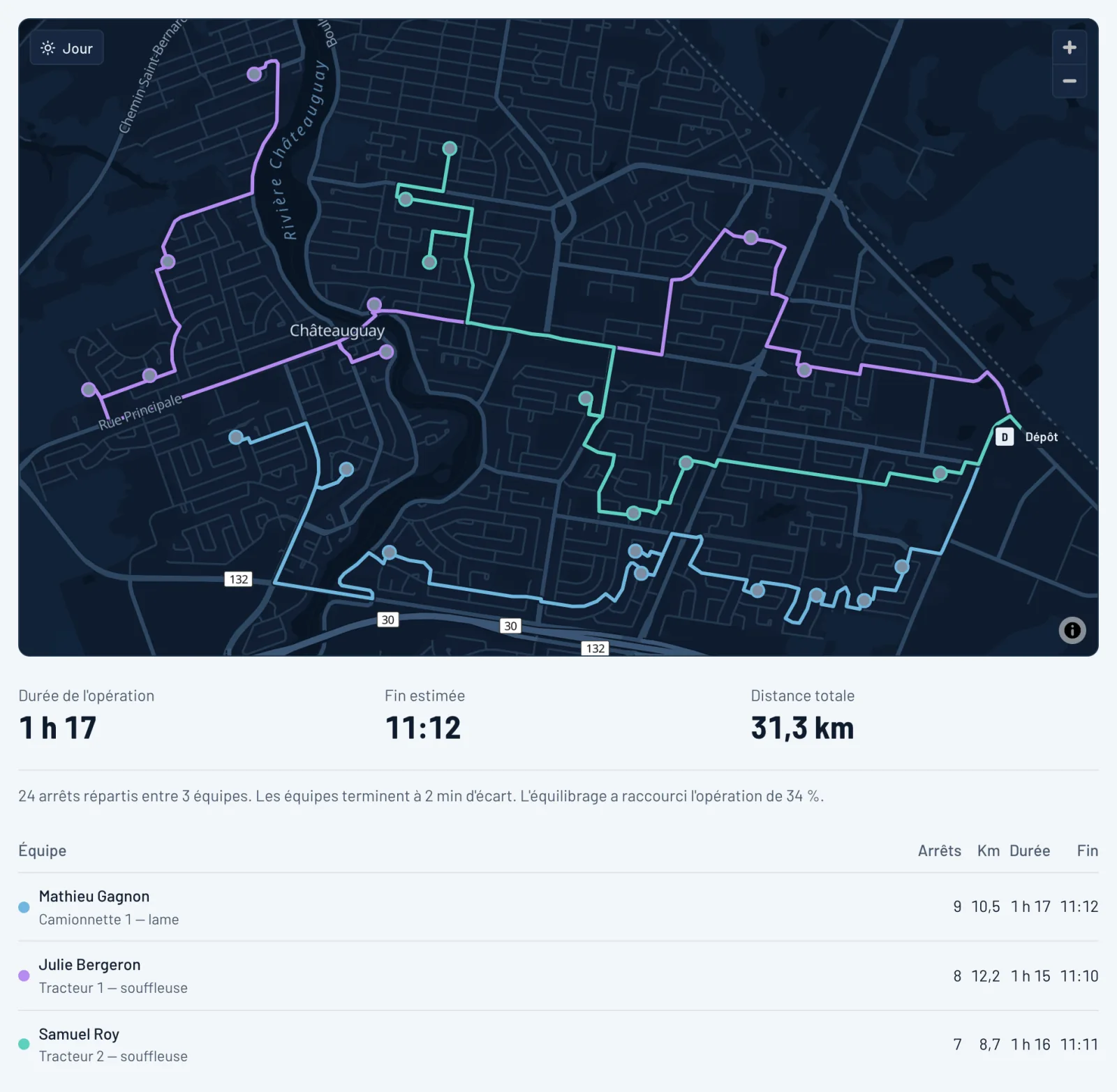
An operation plan: 24 stops split between 3 crews (fictional data, French interface). -
During the storm: Each driver follows their route
The driver gets their route in the app and hands off to the navigation app of their choice (Google Maps, Waze or Apple Maps) from stop to stop. They mark each stop done, or as a problem with a note and a photo.
On arrival, the map switches by itself to the site plan, turned so the street is at the bottom: what to clear, where to put the snow, what to avoid.
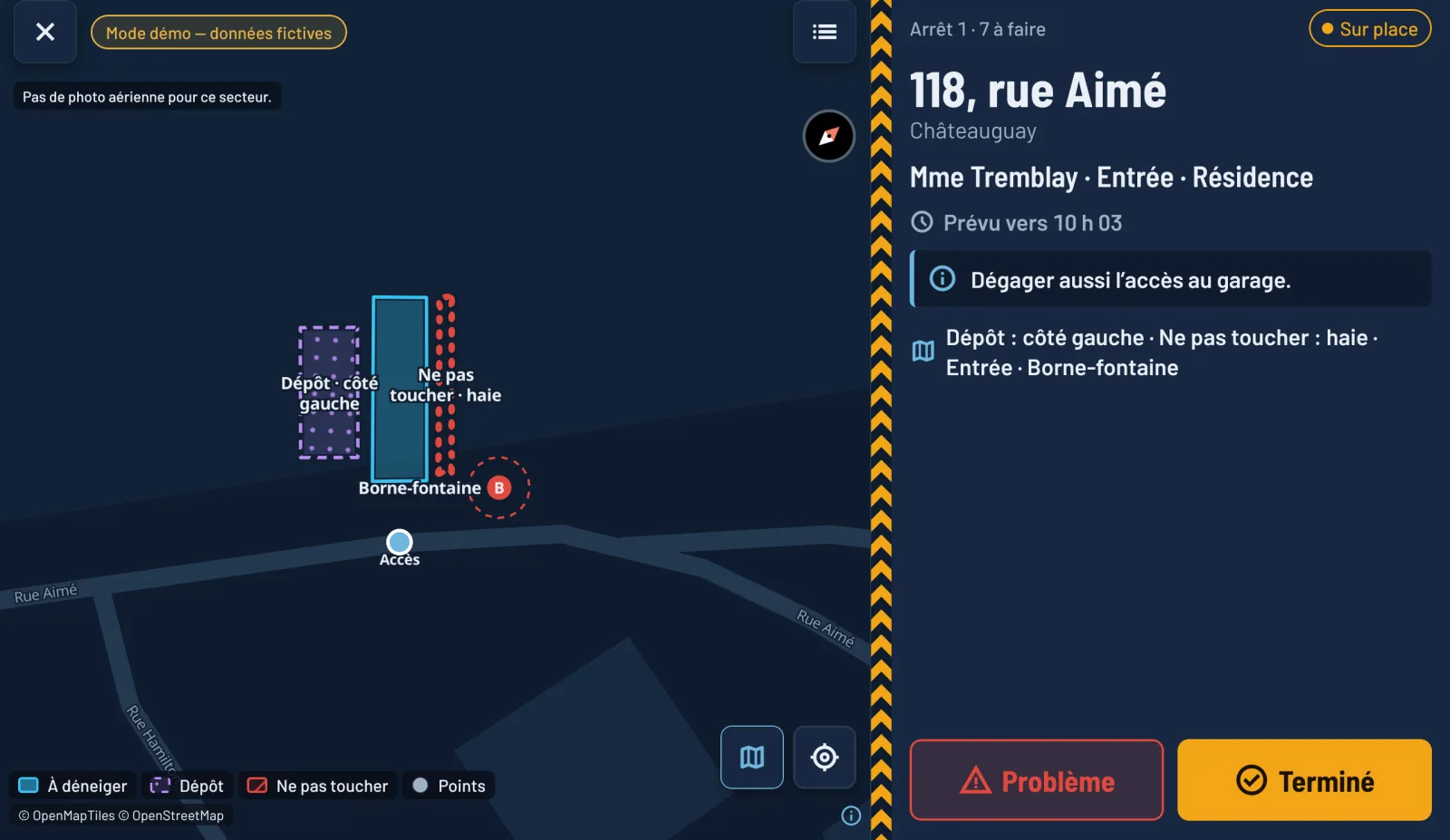
The driver app on a tablet, in demo mode (fictional data, French interface). -
Live, then in the morning: You follow along, then you have proof
The control room shows every crew’s position, the progress and the log, at the office or on your phone. You can reassign a stop, put a problem stop back in the queue or rebalance the workload between crews.
At the end, the report gives the stops done, the problems, the duration and the kilometres, with a CSV export. Every stop keeps its time, position and author, and the log cannot be edited afterwards: it is your proof of service in a dispute.
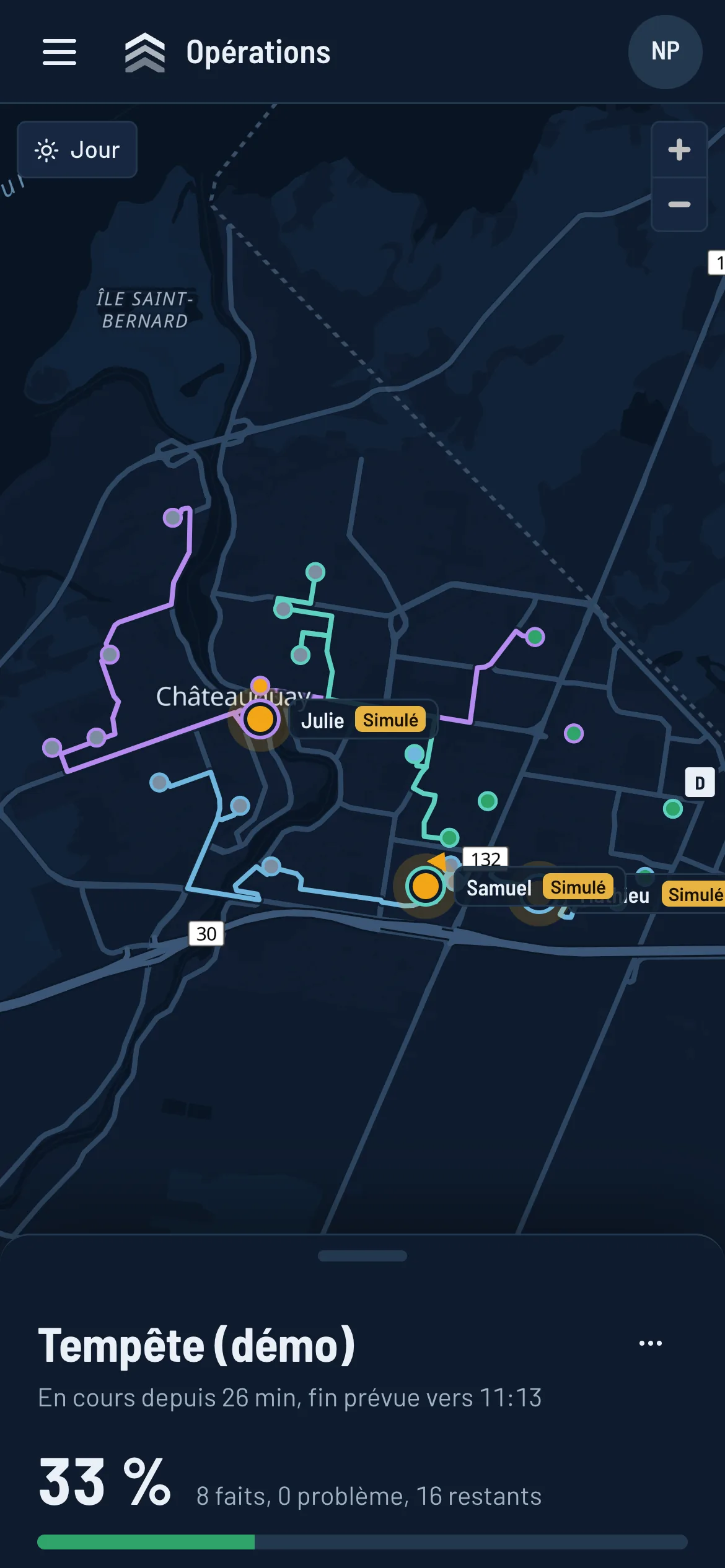
The control room on a phone (fictional data, simulated crews, French interface). 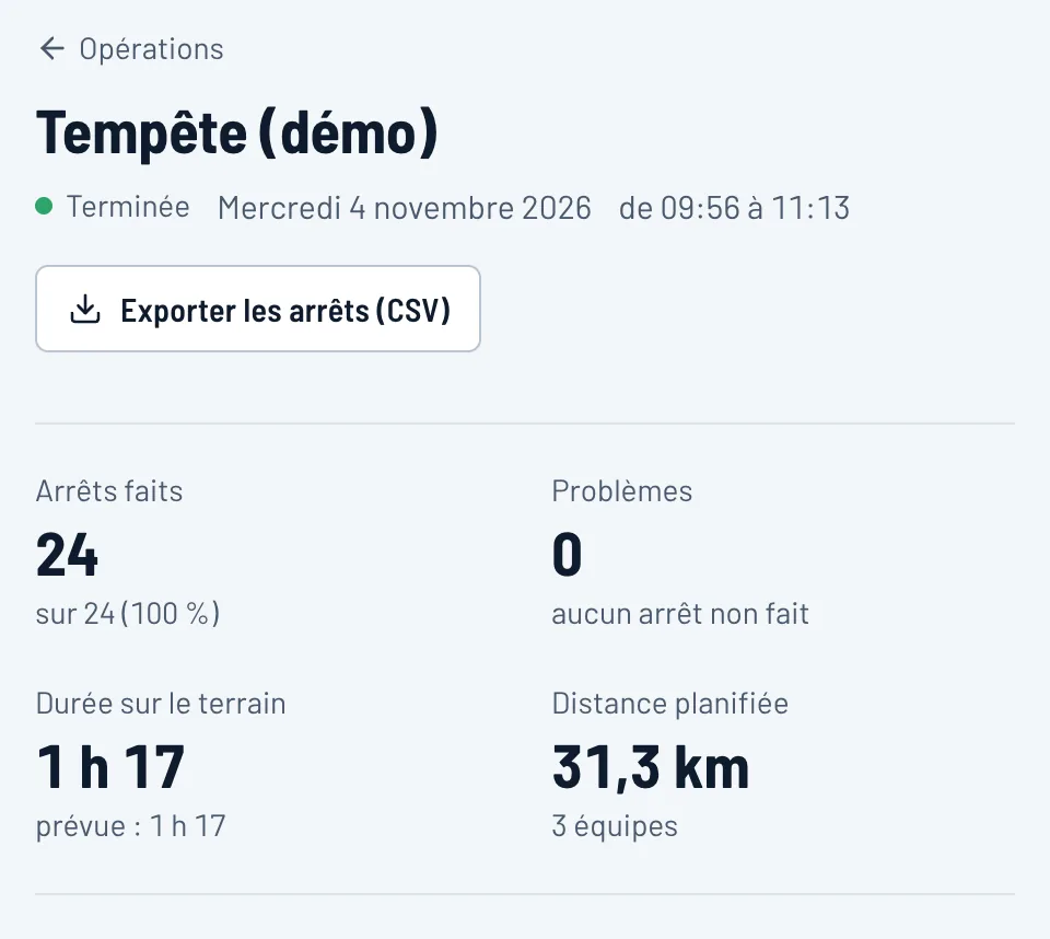
In the morning, the report: here, an operation simulated in real time (fictional data, French interface).


The site plan, drawn on the aerial photo
An address does not say what to clear. Once a season, draw each site on the aerial photo: a three-click rectangle covers most driveways.

Three categories, readable at night and never by colour alone
- To clear: driveway, parking lot, private road, sidewalk or path
- Snow storage: where the snow goes
- Do not touch: hedge, flower bed, anything to avoid
Plus points: fire hydrant, drain, obstacle.
If the office corrects a plan during the storm, the stops not yet done get the new version, with the list of changes. A stop already done keeps the plan that was asked for.
The area of each zone is computed. The “Sans plan” (no plan) tab of the customer list and the “Enregistrer et suivant” (save and next) button let you draw your whole customer base in one go at the start of the season.
The driver app, made for the cab
Designed for the night, for gloves and for a device mounted on the dashboard.

Tablet or phone
For iPhone, iPad and Android phones and tablets. In landscape, the map and the stop share the screen; on a tablet, text and buttons get bigger so they read at arm’s length.
Driving lock
Above 9 km/h, input is locked and navigation stays on screen. A crewmate can act while moving with passenger mode, which is logged.
Built for dead zones
Every action is kept on the device and sent when the network is back, never twice.
Location during the route only
Tracking starts at “Démarrer ma route” (start my route) and stops at “Terminer ma route” (finish my route). No hardware to install: the driver’s device does the tracking.
Paired in seconds
An 8-character code or a QR code, issued from the Employees page of the web app.
At the office
Your customers, your sites, your crews and the history of every storm, in one place.
- Customers and sites, with Adresses Québec certified addresses, a service type and instructions.
- Employees and vehicles: pickup, tractor, loader or sidewalk machine.
- Day map and night map.
- Operation history and a CSV export of each operation.

Your data, hosted in Québec
- Hosted in Québec, by OVHcloud, in the Beauharnois data centre.
- The basemap and aerial photos come from our own server: no outside map service sees the maps you view. One exception: when a driver taps “Naviguer” (navigate), the navigation app they chose (Google Maps, Waze or Apple Maps) receives the stop’s destination.
- Drivers’ GPS tracks are collected during the route only and deleted automatically 12 months after the operation ends; stop photos, after 24 months. Proof of service (stops, times, log) is kept as long as you are a customer.
- No advertising, no analytics or tracking tools, no sale of information.
- Each company is isolated from the others.
Where Snowbec is offered
Snowbec is offered first on Montréal’s South Shore, in its pilot phase. The addresses of these 11 municipalities are loaded:
- Beauharnois
- Candiac
- Châteauguay
- Delson
- La Prairie
- Léry
- Mercier
- Saint-Constant
- Saint-Isidore
- Sainte-Catherine
- Sainte-Martine
For now, the aerial photo covers Châteauguay, Léry, Mercier and part of the neighbouring municipalities. Where it is missing, the plan editor works on the street map.
Is your company elsewhere in Québec? Write to us: each region needs its maps, addresses and aerial photos prepared.
Questions
Which device do drivers need?
A tablet with GPS, or simply a phone, with a data plan. For a tablet, choose a cellular model, such as an iPad Wi-Fi + Cellular: most Wi-Fi-only tablets have no GPS chip.
Do vehicles need a tracking box?
No. The driver’s tablet or phone does the tracking during the route.
Are drivers tracked outside work?
No. Location is collected only between “Démarrer ma route” and “Terminer ma route” (start my route, finish my route). The app never asks for “Always” location access. Before asking, it shows a notice that names the employer.
Does the app work without a network?
Yes for actions: “Arrivé” (arrived), “Terminé” (done) and “Problème” (problem) are kept on the device and sent when the network is back, never twice. The route stays on the device, and the sites’ aerial photos are downloaded ahead of time.
Is my region covered?
During the pilot, Montréal’s South Shore (see Where Snowbec is offered). For another region, write to us.
How do I get started?
Write to us at contact@nordbec.ca. During the pilot there is no online sign-up: we set up your company’s account with you.
Let’s talk about your season
Tell us how many crews and sites you have, and in which municipalities.